
Allentown Aerial Surveys, Photography, and Videography
Pennsylvania Aerial Intelligence
Allentown Helicopter Charters provides unparalleled capabilities for diverse aerial survey requirements across Pennsylvania. Our solutions encompass advanced applications such as magnetometer and electromagnetic surveys, precision LiDAR scanning, and comprehensive GIS mapping. The inherent low-altitude flight and stable hover capabilities of helicopters ensure exceptional data fidelity and collection efficiency. Furthermore, we deliver specialized aerial cinematography and photography services, deploying state-of-the-art technology, including gyro-stabilized mounts or door-off configurations for handheld operations. For comprehensive aerial intelligence and visual content acquisition within the greater Lehigh Valley and beyond, our operational breadth remains unmatched.
Aerial
Surveys
LiDAR, GIS Maps, FLIR, HD Video & More
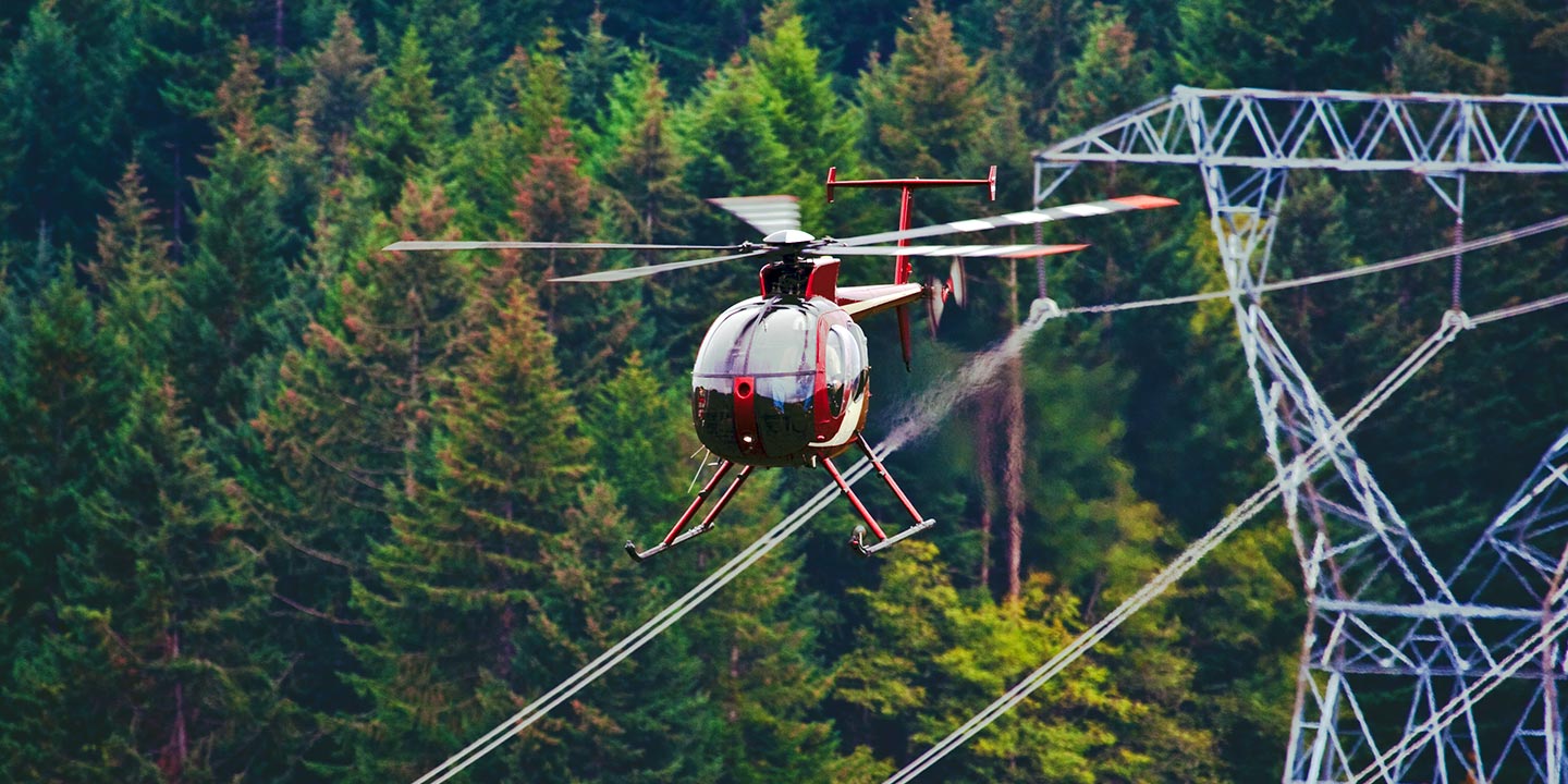
Allentown Helicopter Charters offers precise solutions for critical infrastructure integrity. From pipeline integrity surveys and Right-of-Way (ROW) inspections to transmission line patrols across Pennsylvania, we provision optimally equipped aircraft. This ensures efficient data collection and detailed visual assessments, completing your vital projects accurately.
High Tech Results
The Top Pilots in Pennsylvania, Today's Technology... Maximum Results.
Call 1-866-826-4826 Now!
Allentown Helicopter Charters provides the tools needed to complete your land surveys, utilizing the right equipment to provide the aerial photos that are often needed.
Effective aerial surveys are indispensable for streamlining critical commercial projects, including Right-of-Way (ROW) and site inspections, comprehensive topographical data acquisition, and high-definition photography. Helicopter platforms offer an unmatched advantage for surveying the diverse Pennsylvania terrain, precisely identifying pipeline leaks, detecting transmission line anomalies, or capturing detailed property visuals. Allentown Helicopter Charters specializes in developing bespoke photographic and remote sensing operations. These customized solutions are engineered to maximize both technical and financial efficiency, ensuring superior data collection and optimal project outcomes for our clients in the Lehigh Valley and surrounding regions.
For precise aerial surveying, the helicopter's unique flight envelope offers distinct advantages over fixed-wing aircraft. Capable of significantly lower altitude operations and reduced airspeeds, helicopters are optimal platforms for detailed data acquisition. While FAA regulations mandate fixed-wing aircraft maintain a minimum of 1,000 feet above the highest obstacle, helicopters can operate at much lower altitudes, enabling granular inspections. This capability is crucial for examining challenging or hazardous zones, providing engineers with an otherwise unattainable vantage point for critical assessments in Pennsylvania.
There is no better way to conduct your visual survey, animal population counts, soil drainage analysis, ROW inspections, pipeline and transmission line inspections, and geographical surveys.
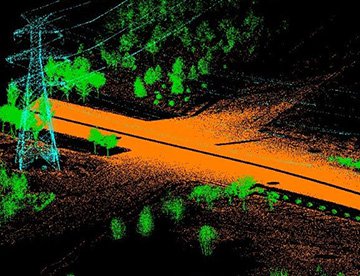
LiDAR Imaging
Light Detection and Ranging, or LiDAR, is a remote sensing method used to examine and measure Pennsylvania topography as well as objects, like vegetation, upon it.
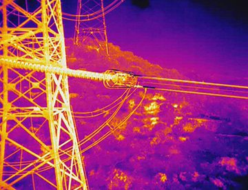
Infrared Imaging
Thermographic IR cameras are used to detect radiation in the long-infrared range of the electromagnetic spectrum and produce images of that radiation, called thermograms.
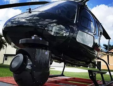
HD Video Gimbal Capture
Modern HD and 4K cameras can be mounted to helicopters, using the proper STCs, with a gimbal to stabilize photos & videos for detailed results.
Advanced Aerial Filming and Professional Videography Services
For expert camera work in the Allentown Sky
Get a Fast, free QuoteAllentown Aerial Cinematography
Allentown Helicopter Charters delivers comprehensive resources for professional-grade aerial cinematography across Pennsylvania. We provide access to cutting-edge technology for custom shoots, featuring a robust selection of gyro-stabilized camera mounts, including industry-standard systems such as Tyler Mounts, Wesscam, Cineflex, Pictorvision, and SpaceCam. These integrate seamlessly with specialty cameras like Cineflex HD, RED Epic, and Arri Alexa, alongside advanced 3D and experimental camera systems. Our capabilities support all facets of your production, from dynamic air-to-air sequences to precise ground-to-air perspectives, ensuring your cinematic objectives are met with precision. We facilitate close collaboration between flight operations and your aerial Directors of Photography and directors, translating creative visions into stunning visual results. Specializing in helicopter platforms for both still and motion photography, Allentown Helicopter Charters supports nearly every media-related operation within the Commonwealth. This includes feature films, television productions, documentaries, promotional videos, commercials, aerial prop positioning, critical relief work for broadcast networks, and extensive coverage of historical and major sporting events throughout the greater Lehigh Valley and beyond.
Call Us Today at 1-866-826-4826 for a Free Quote
Contact Us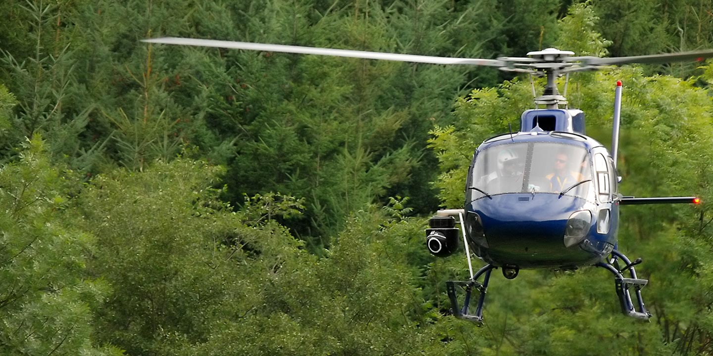
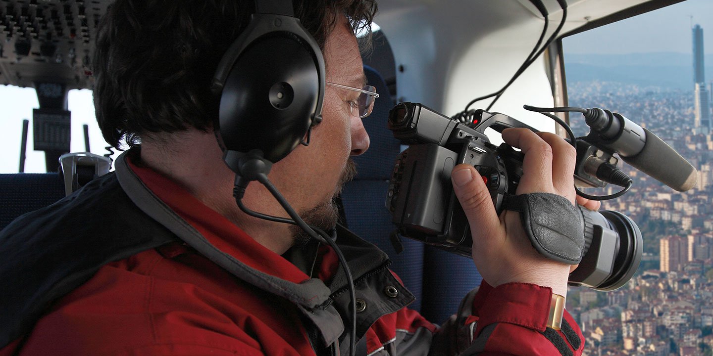
Aerial Photos
Hand-held or Mounted OpTions in Allentown
We will help you get the right equipment for your aerial photography project! Call 1-866-826-4826 today to get a fast, free quote.
The Most Options for Photography
Pennsylvania's spectacular landscapes and urban settings are optimally captured from an aerial perspective. Allentown Helicopter Charters offers specialized aerial photography charters meticulously designed to translate your precise visual concepts into professional-grade imagery. We facilitate exceptional photographic opportunities across the Commonwealth, from the scenic Pocono Mountains to the urban centers of Philadelphia and Pittsburgh, including the Lehigh Valley region. For creative flexibility, many helicopter platforms can accommodate door-off operations for handheld photography. For enhanced stability and precision necessary for high-end projects, information on advanced gyro-stabilized mounting systems is available to ensure the capture of breathtaking, steady shots that exceed industry standards.
Superior Service
Every one of our customers gets a dedicated helicopter expert to assist with flight plans, tech loadouts, production logistics, project schedules, and other demands.
Over 500 Aircraft
Our network of direct air partners extends well beyond Allentown, Pennsylvania. This allows us to offer a wide range of solutions for even the most sophisticated projects.
The Best Equipment
From high-tech sensors like LiDAR, FLIR, and GIS to HD cameras and movie production gimbals, we're here to make your job as easy as possible.


